Initial Processing
DataDEV utilizes the latest versions of post processing software, enabling us a turnaround time on the scale of days and not weeks.
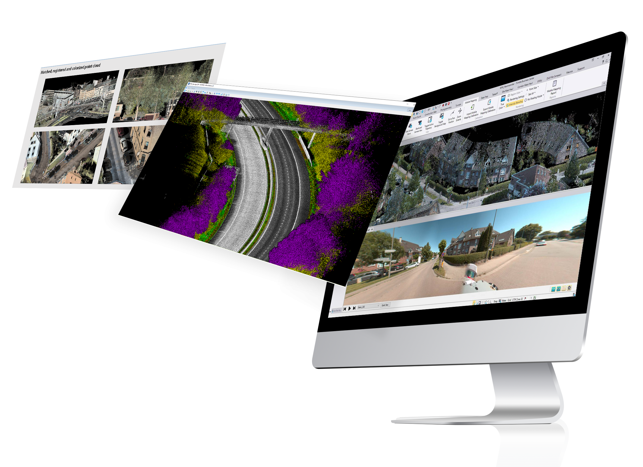
Raw data is unsatisfactory in terms of the required accuracy. Trajectory post processing needs to be done, using corrections of GNSS, DMI and GAMS trajectory positions with the help of base station data. The format that the data is exported in is SBET (Smoothed Best Estimated Trajectory). Both greyscale and colorized point clouds could be generated based on SBET trajectory in the requested coordinate reference system.
Besides the point cloud, panoramic and planar images can also be generated and could be extracted from the raw data. If requested, AI aided blurring procedure can be applied to these images for privacy protection purposes. Data needs to be prepared for the publisher. Publisher ready project is created by importing panorama and planar images, as well as the point cloud in to the software specialized for that purpose. Publications are created by setting resources, viewing options and access to the users.
Ready to take the first step towards solving geospatial challenges? Don't hesitate to reach out.
We're here to help you every step of the way!
Send us a question or comment and we’ll be in touch with you as soon as possible.