DataDEV awarded top-ranking contract for Deutsche Bahn’s rail infrastructure digitalization

Accelerating the expansion of rail infrastructure is a very important issue. Modern methods for recording the current situation and digital modeling and provision of results enable significantly faster processes. Building on this knowledge, Deutsche Bahn DB-InfraGo has initiated a tender in several lots for multi-year framework contracts for the digital Read more…

INTERGEO 2023

In the world of geospatial technology and innovation, INTERGEO stands out as one of the most prominent and influential events, attracting professionals and experts from all corners of the globe. For the second year in a row, we had the privilege of being a part of this incredible gathering, which took place in Berlin.

LiDAR 101: A Q&A WITH JOVANA

LiDAR (Light Detection and Ranging) is one of the most popular ways to remotely sense the Earth. LiDAR system uses laser rays that are pointed toward the ground and then reflect to the sensor, making 3D models of the terrain and the objects on it. Mobile mapping expert Jovana Babić will explain in a bit more in detail how LiDAR works, as well as the applications of the LIDAR system.

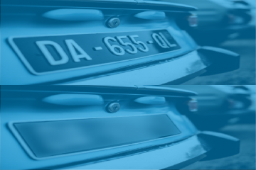
Blurring Street-Level Mobile Mapping Data

Safely share and publish mobile mapping imagery DataBLUR Reliability methodology.  Fully automatic procedures. Plug and play solutions. User friendly environment. Grow your business with us. Why Mobile Mapping image blurring is so important? “‘personal data’ means any information relating to an identified or identifiable natural person (‘data subject’); an identifiable Read more…